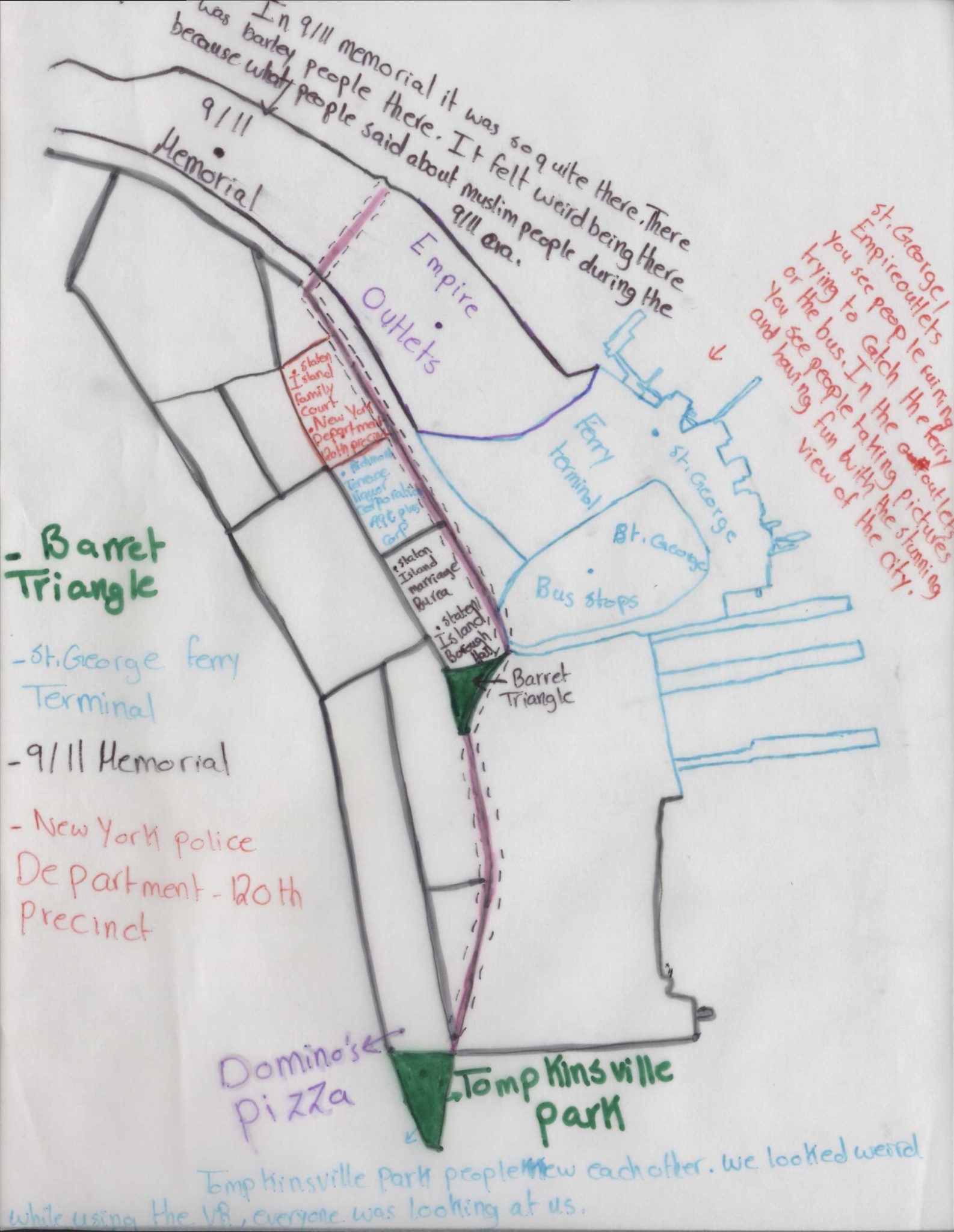
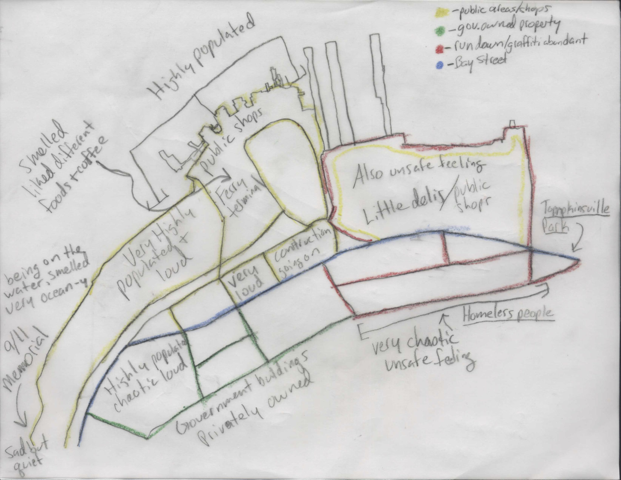
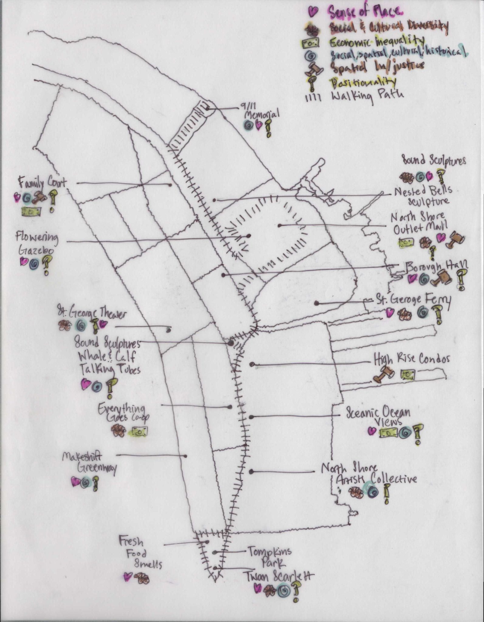
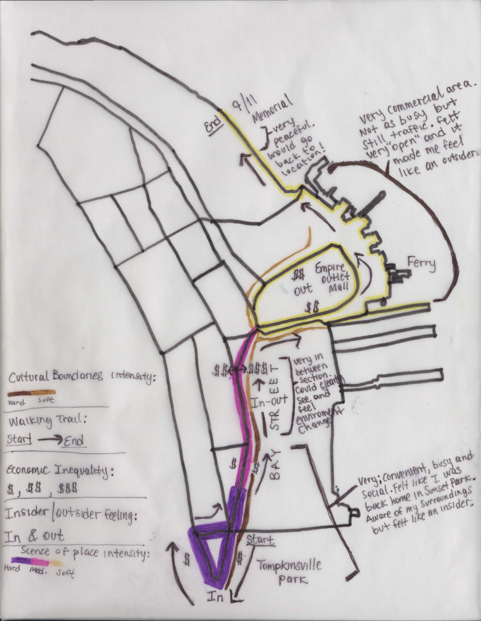
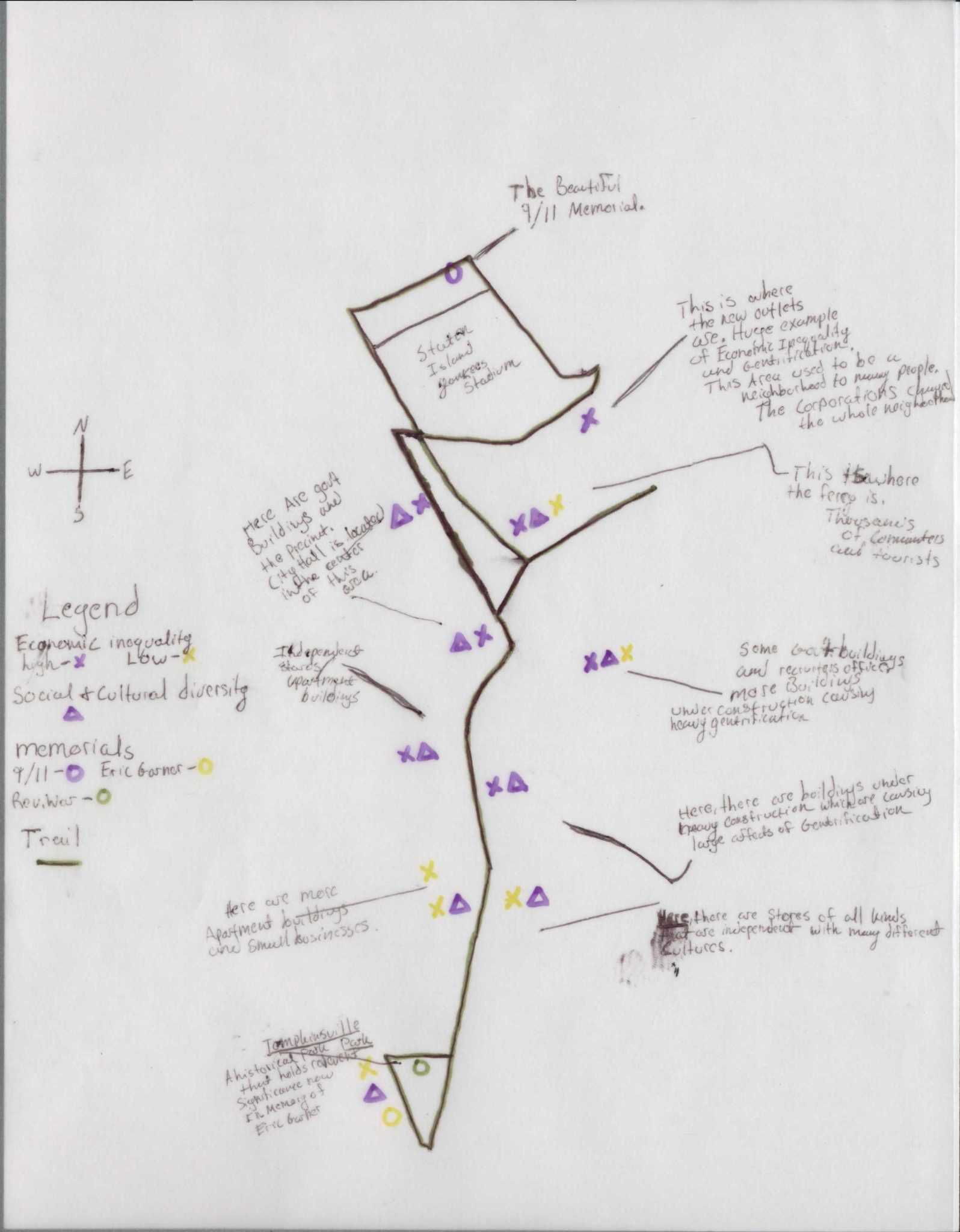
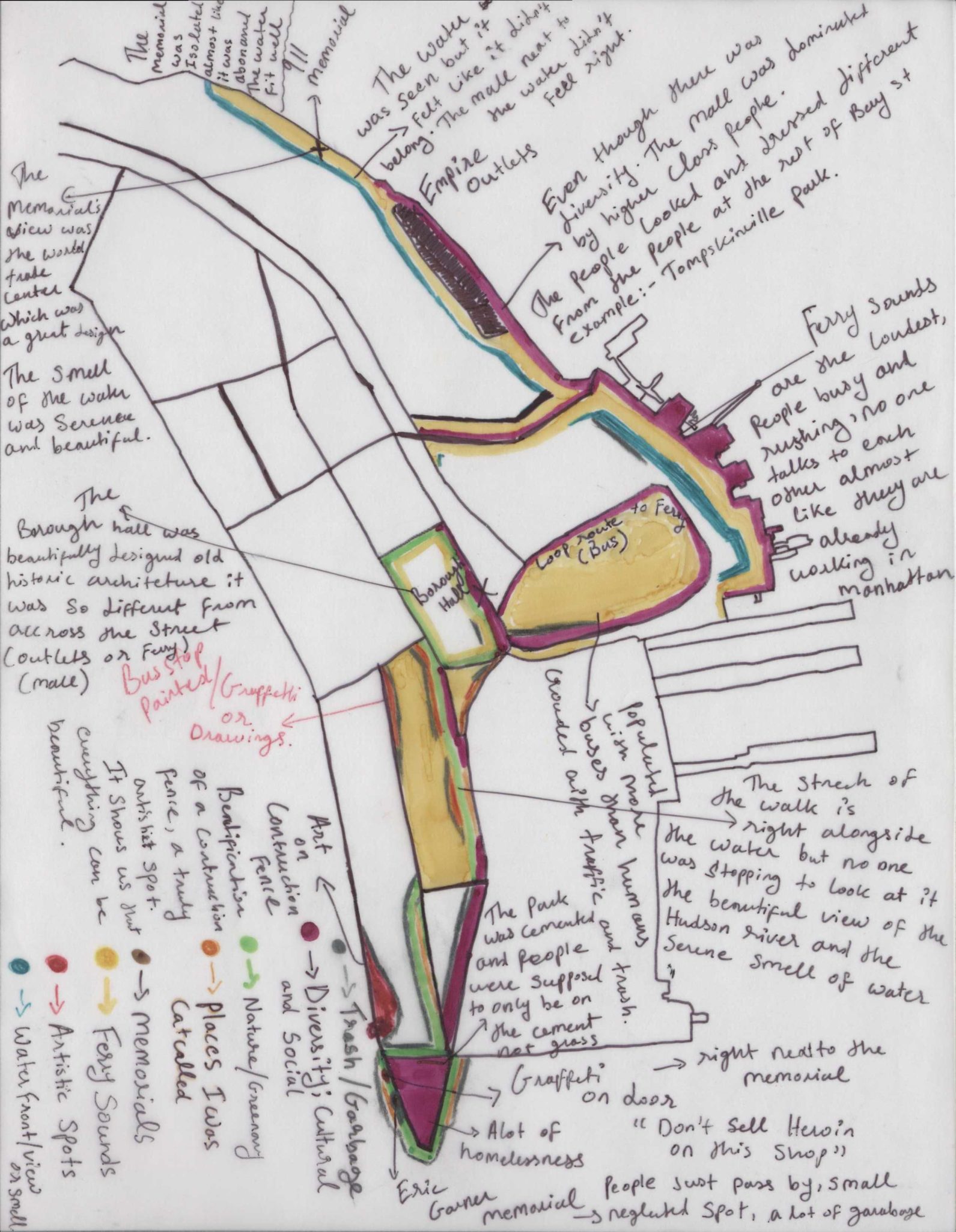
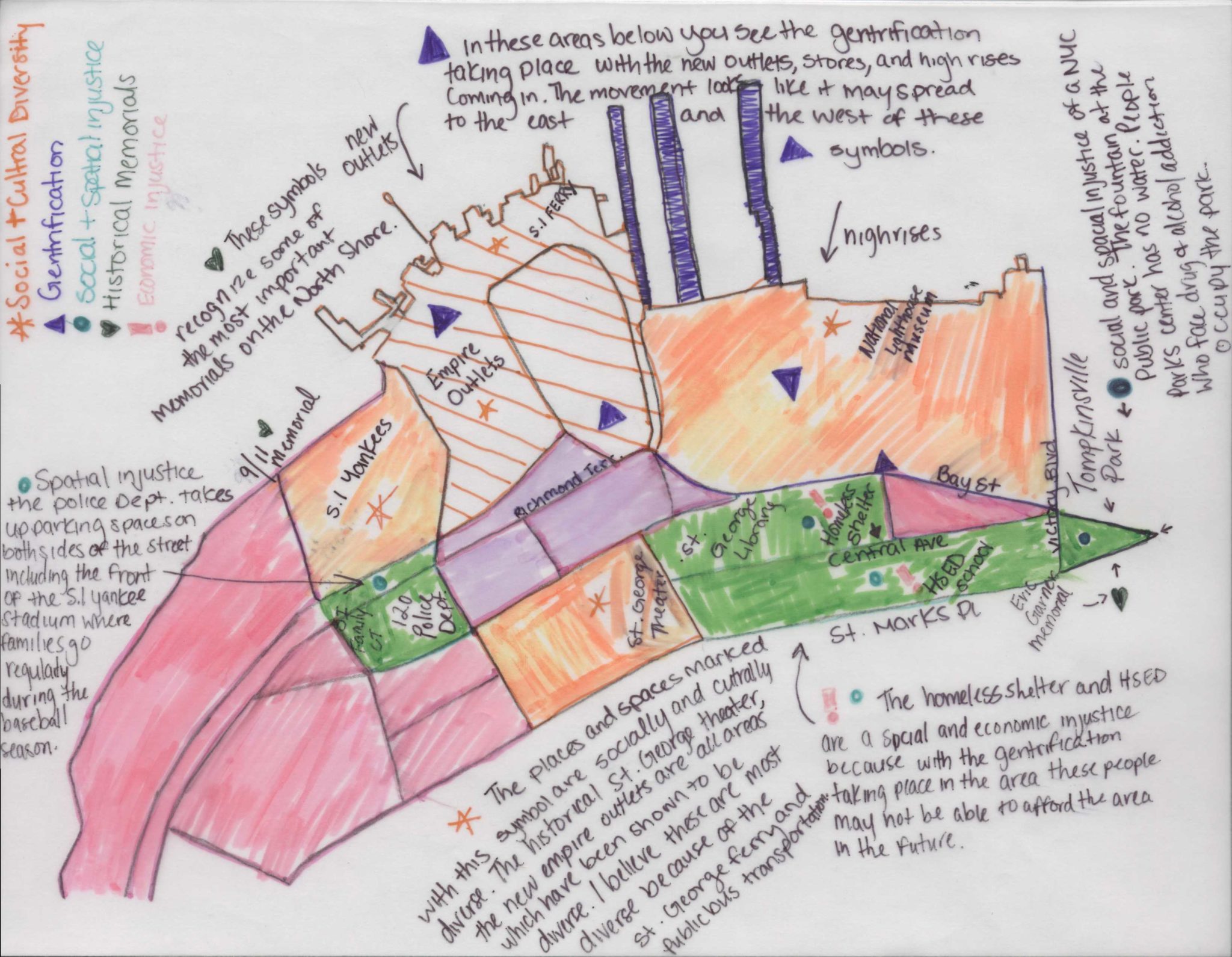
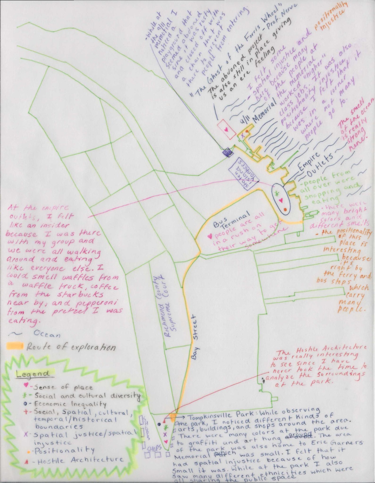
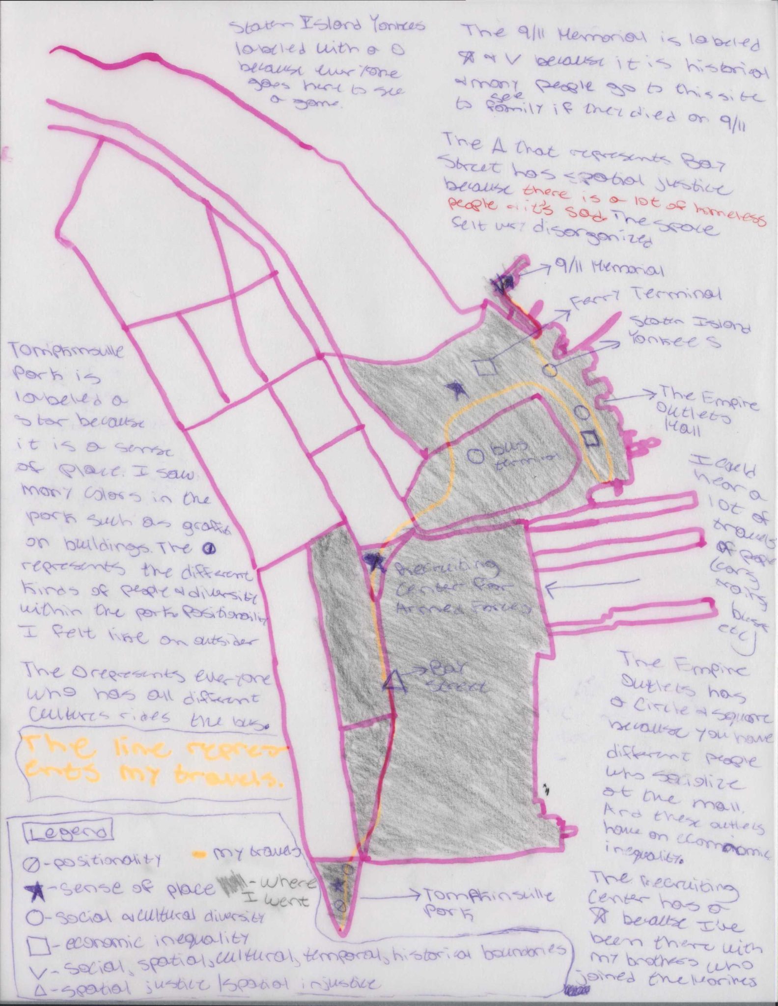
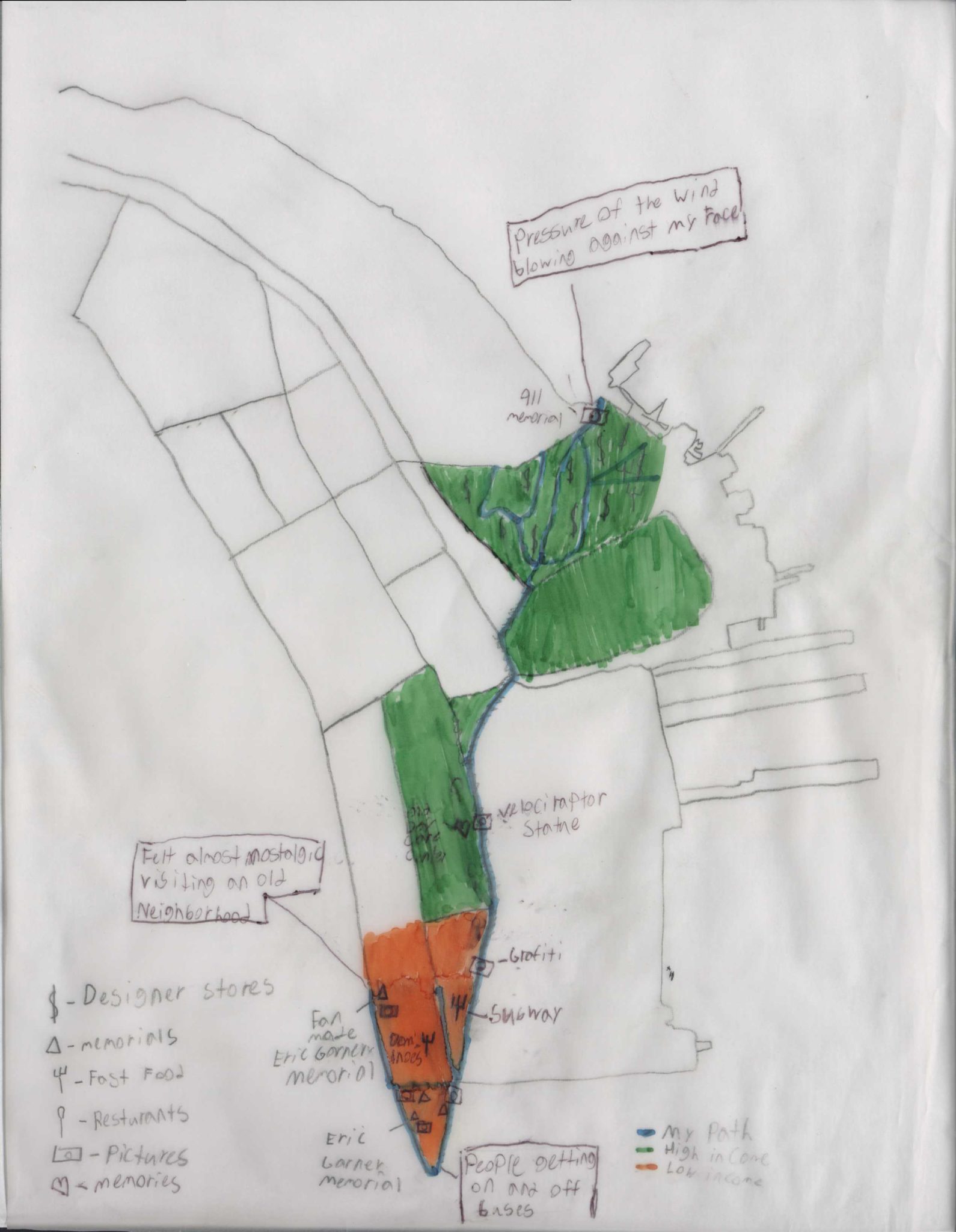
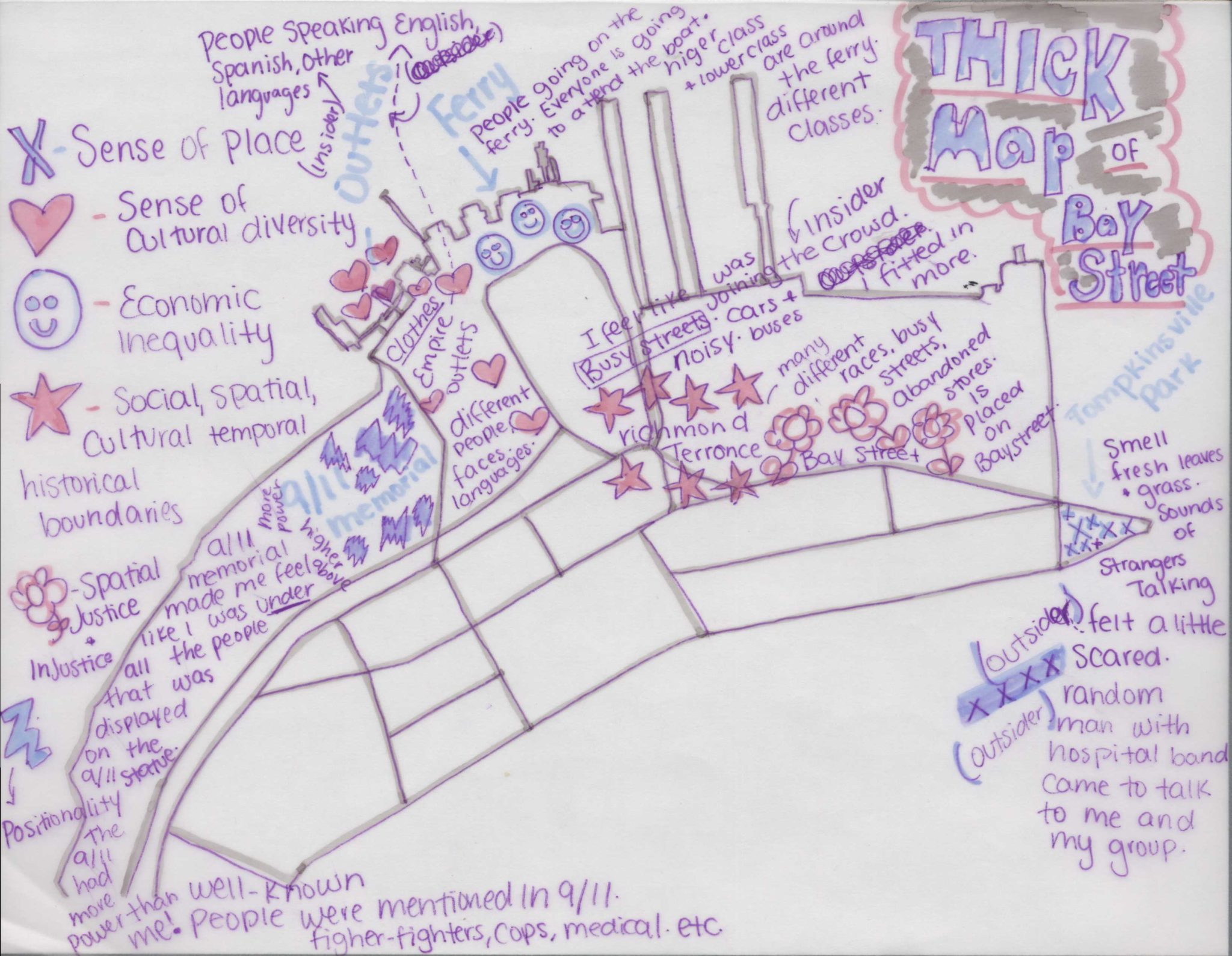
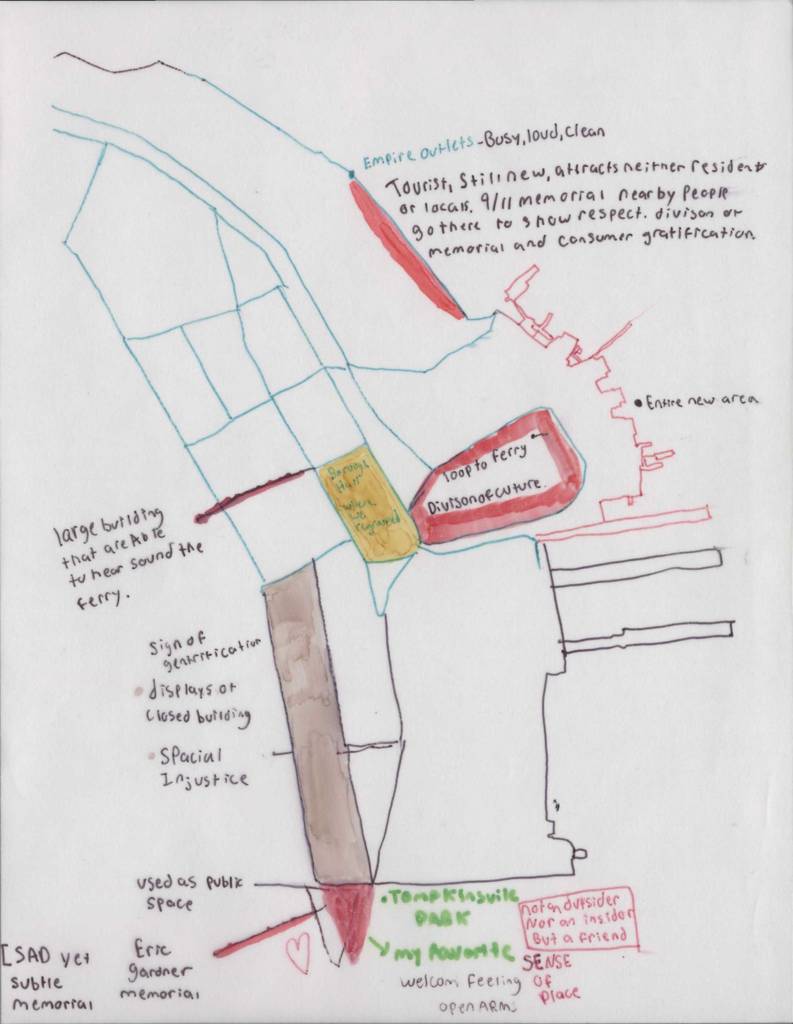
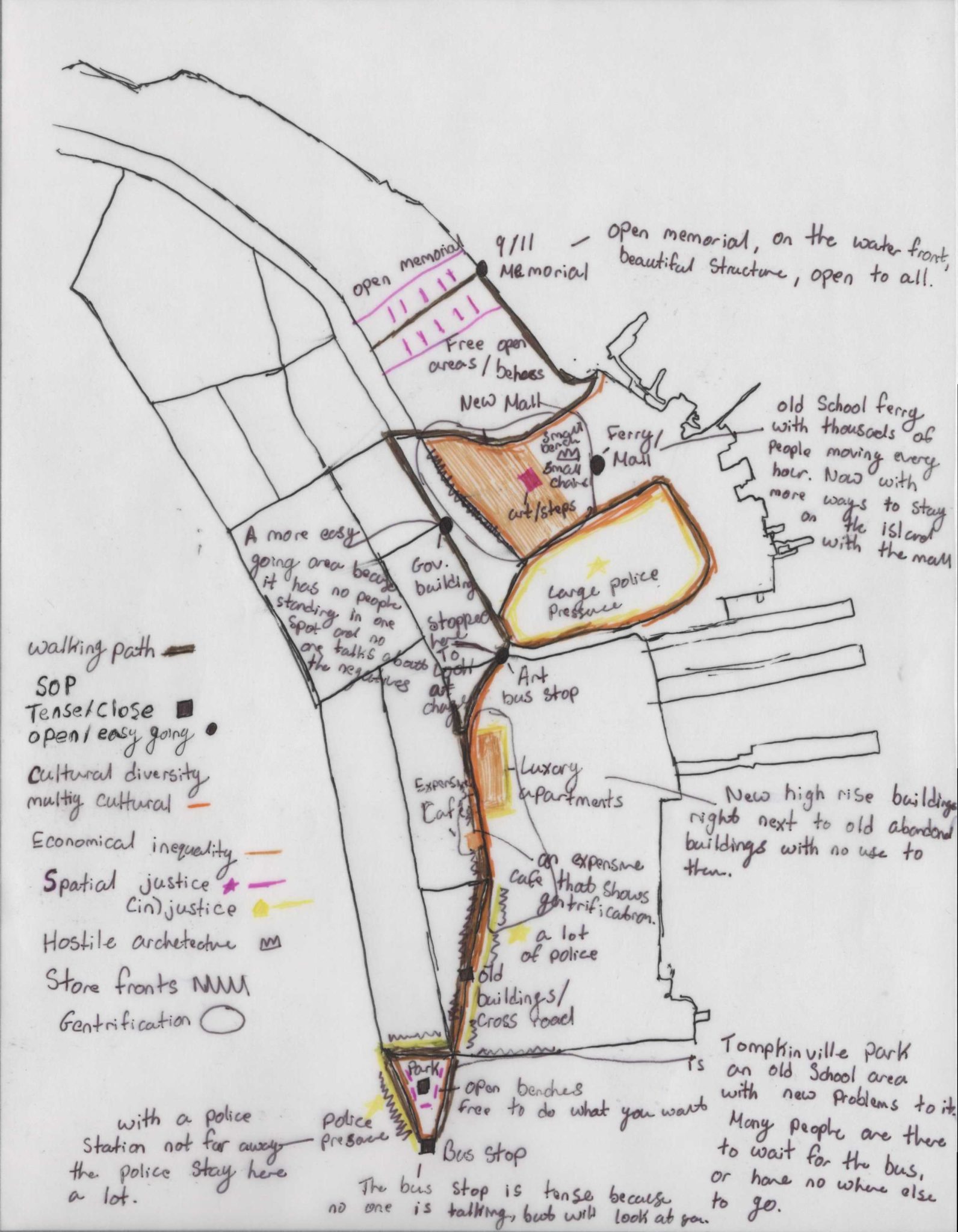
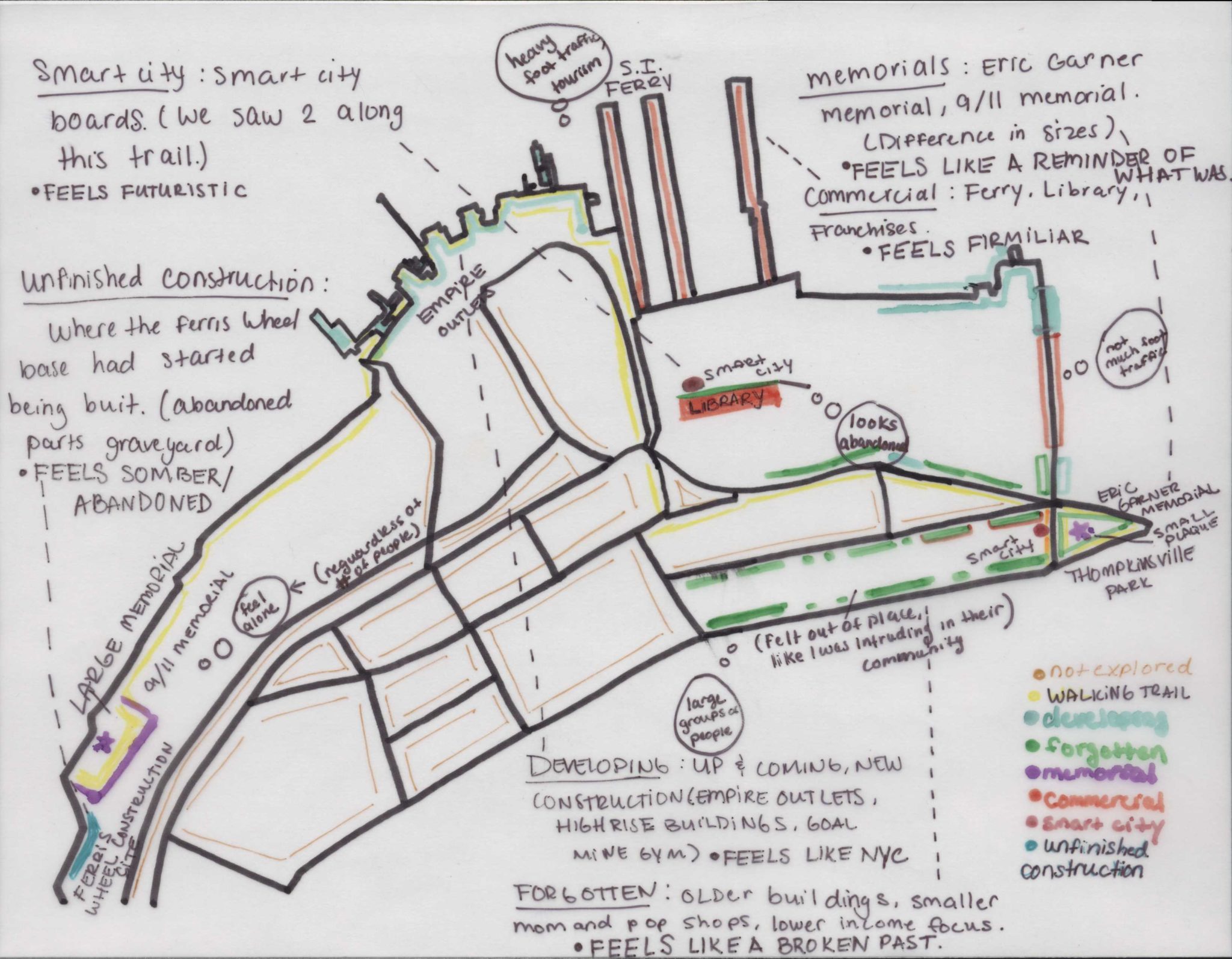
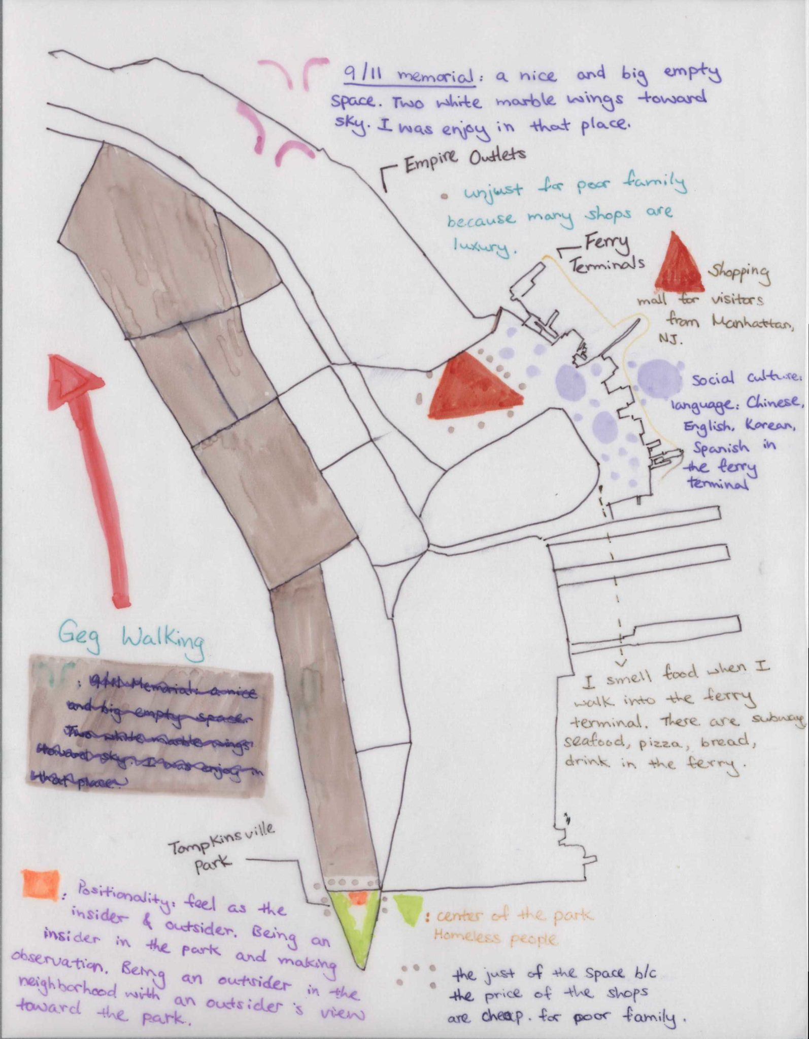
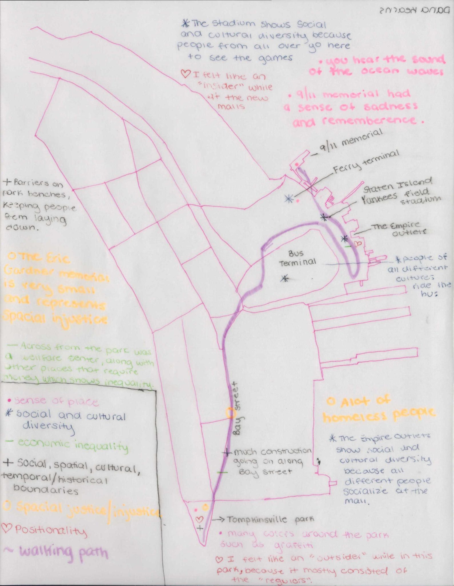
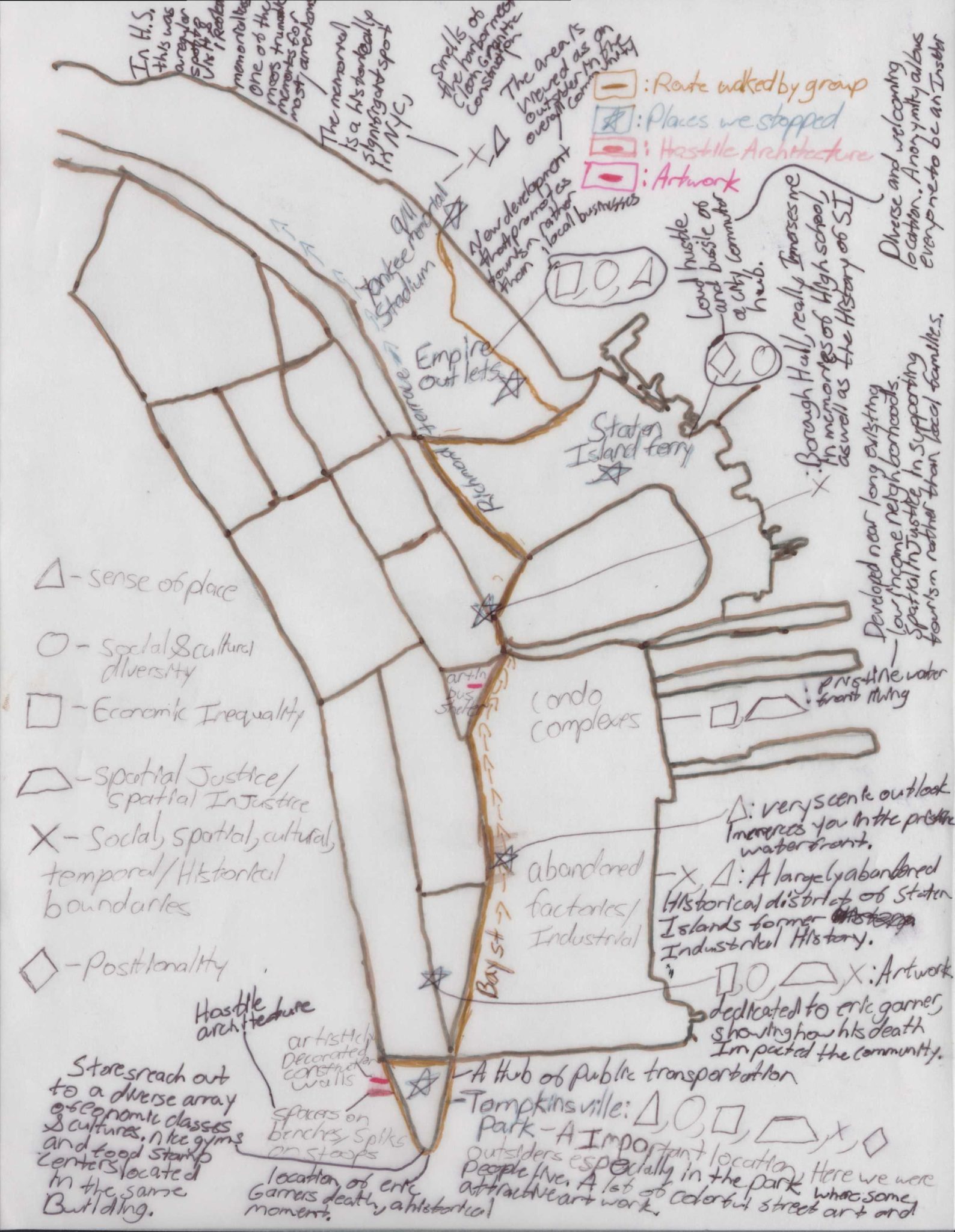
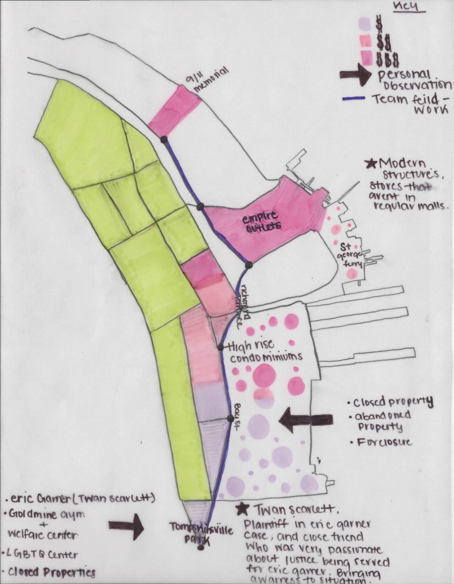
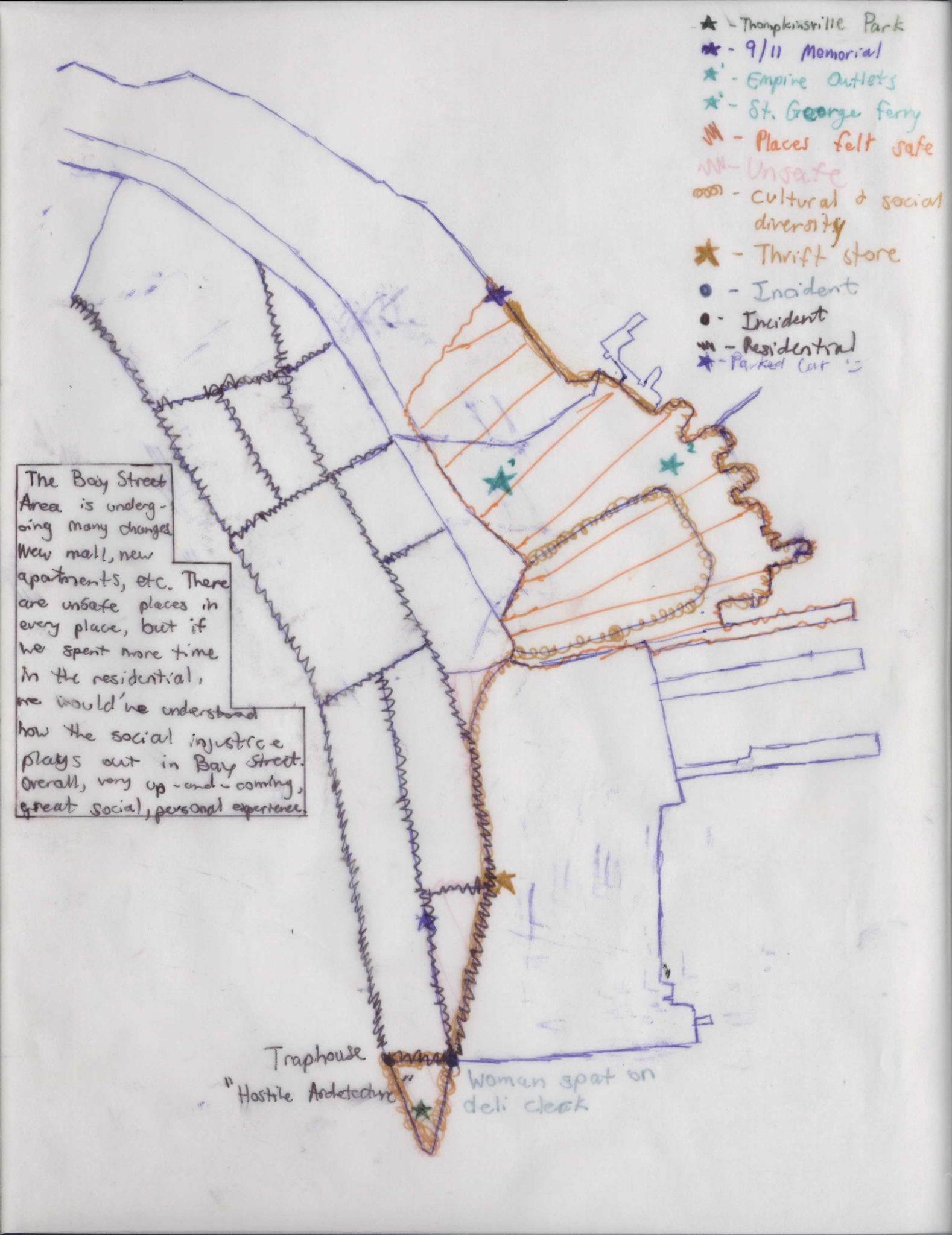
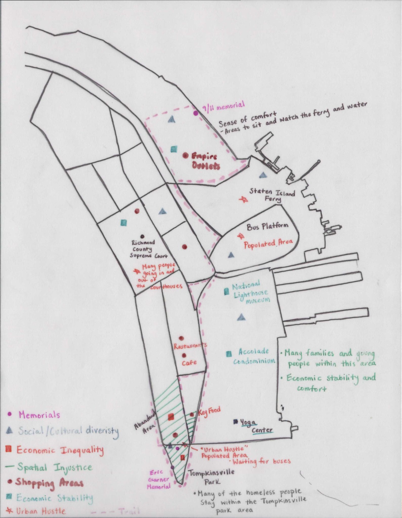
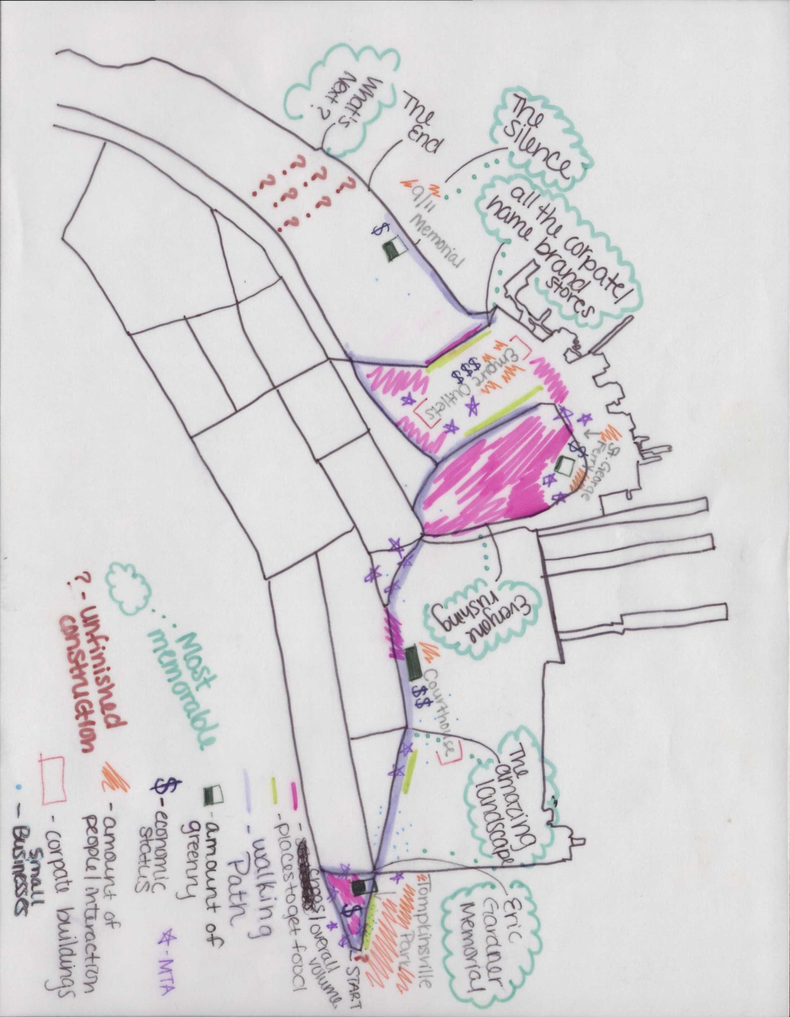
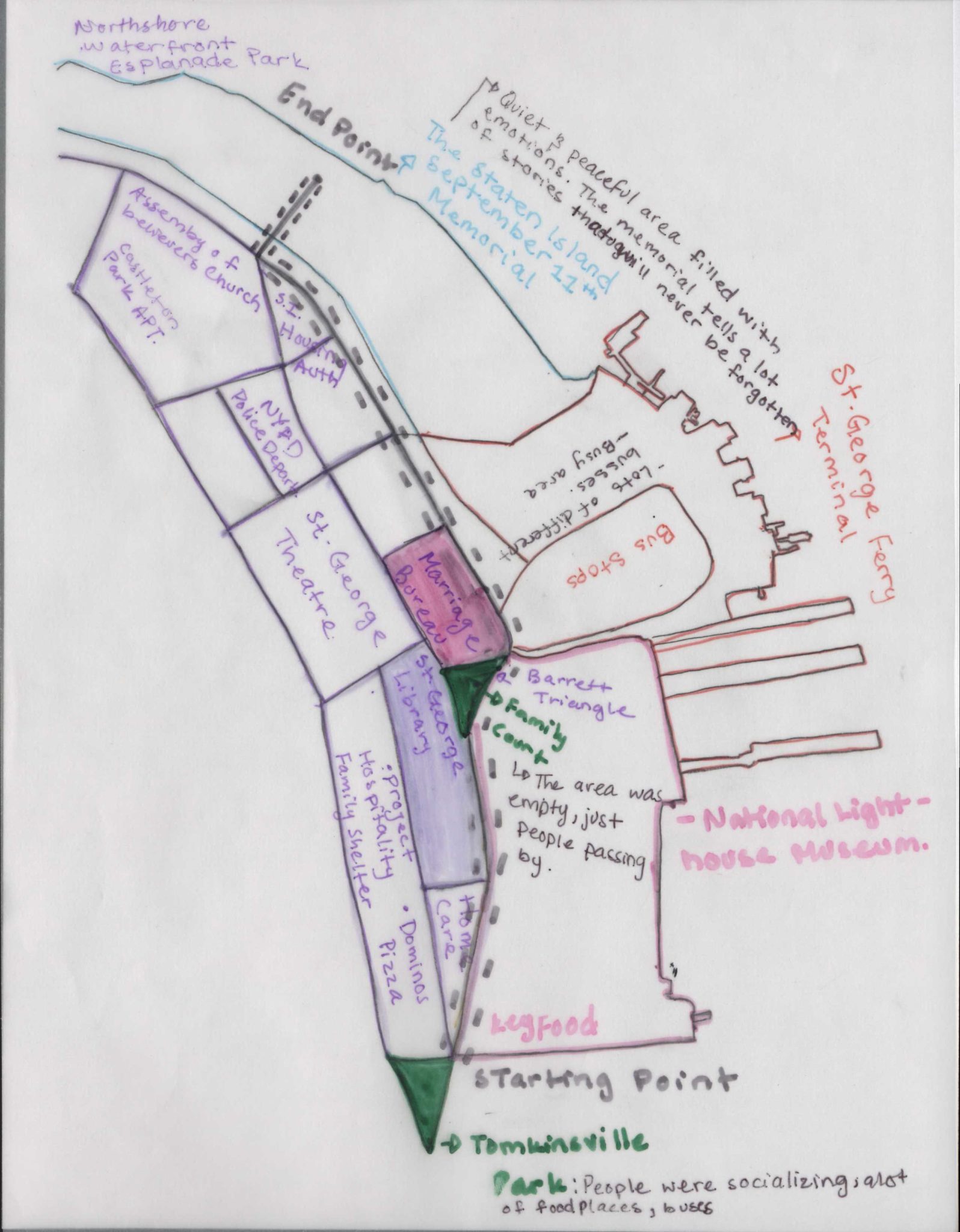
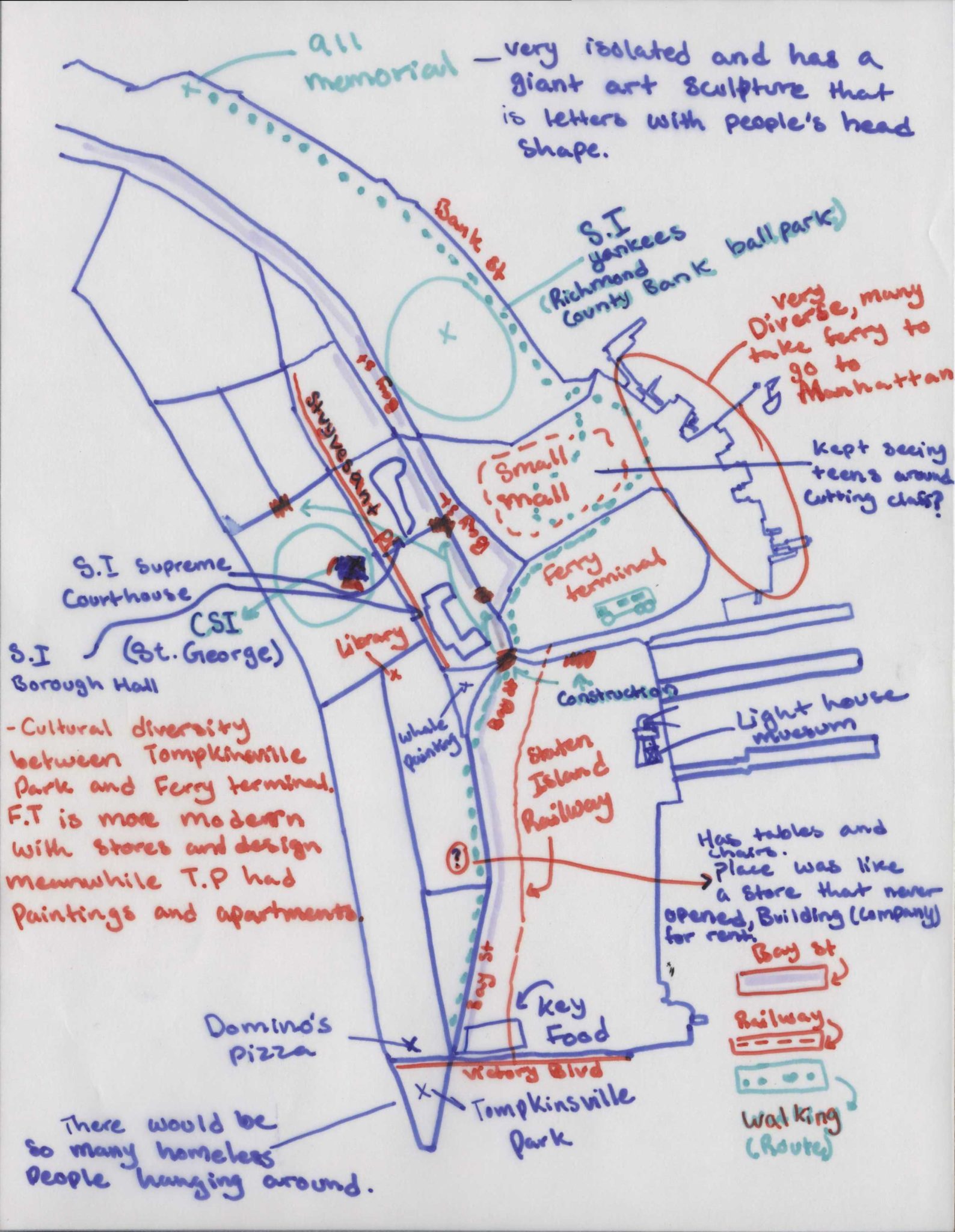
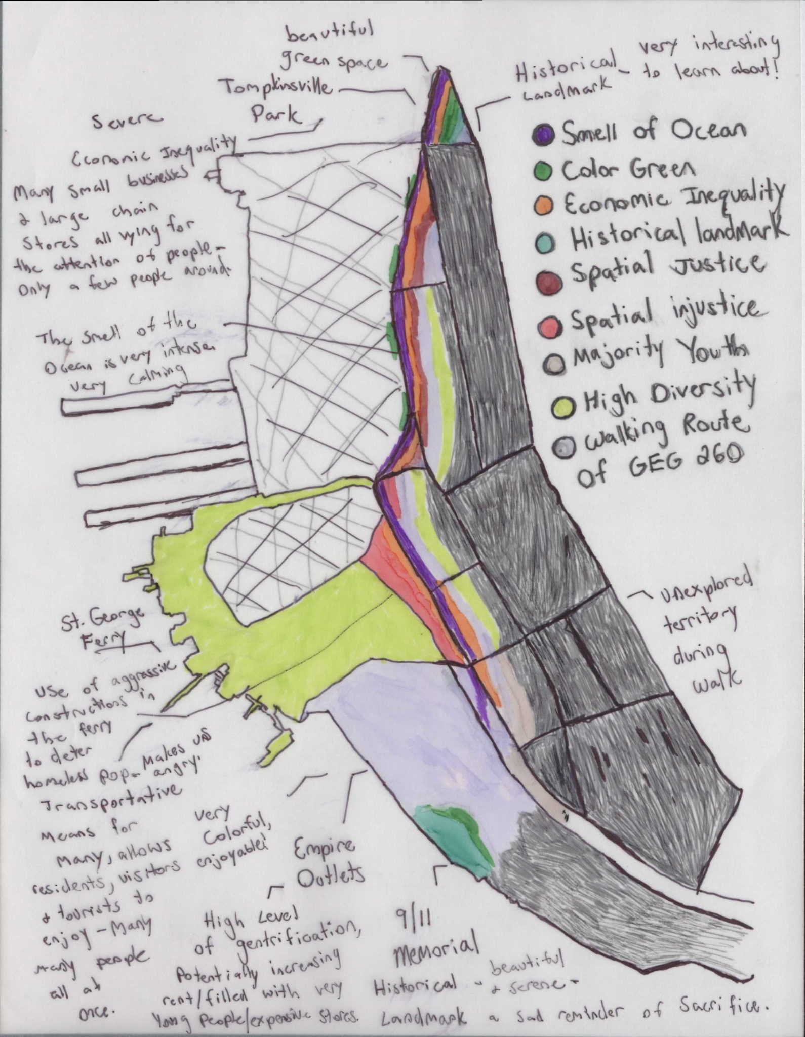
Mapping Bay St.
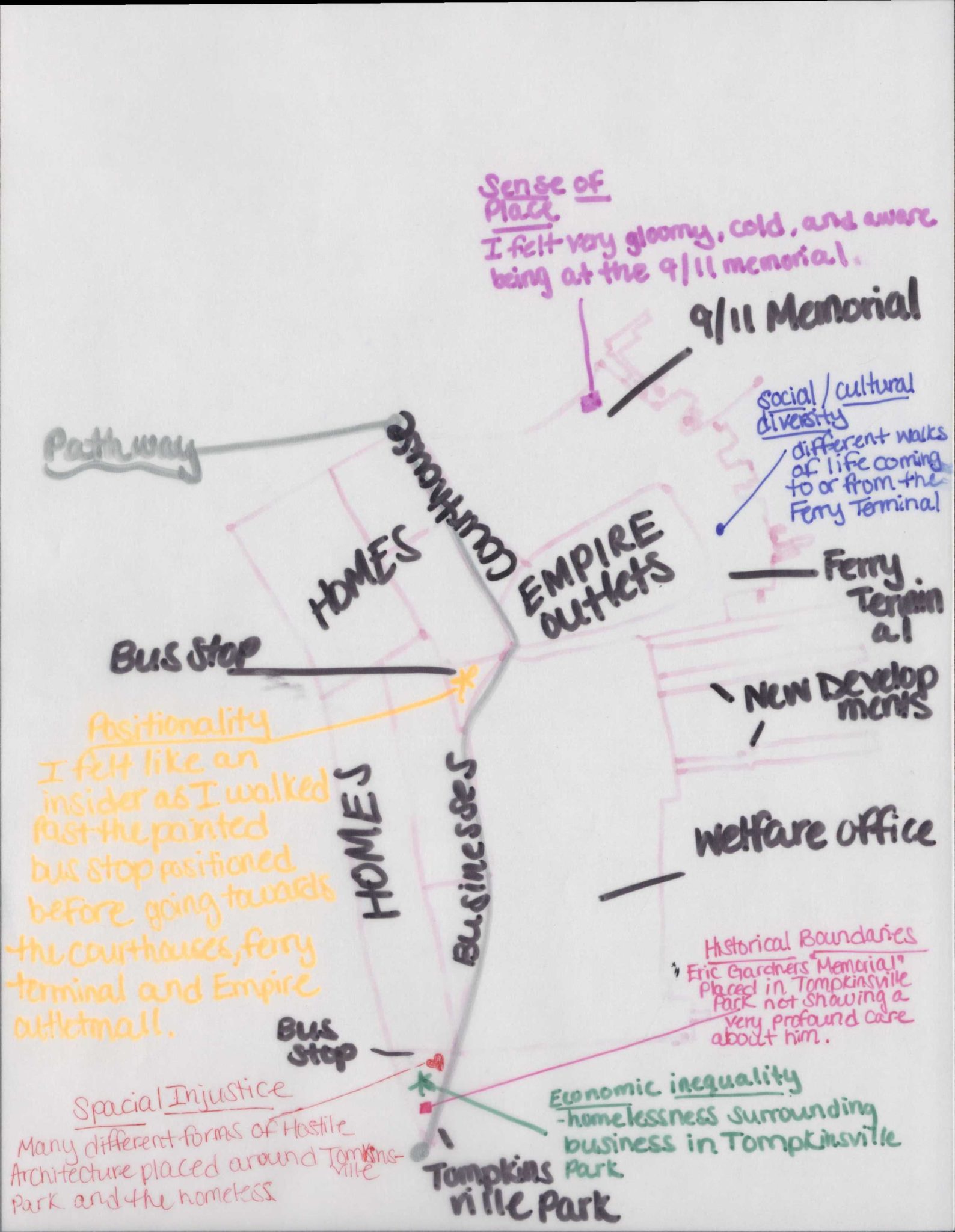
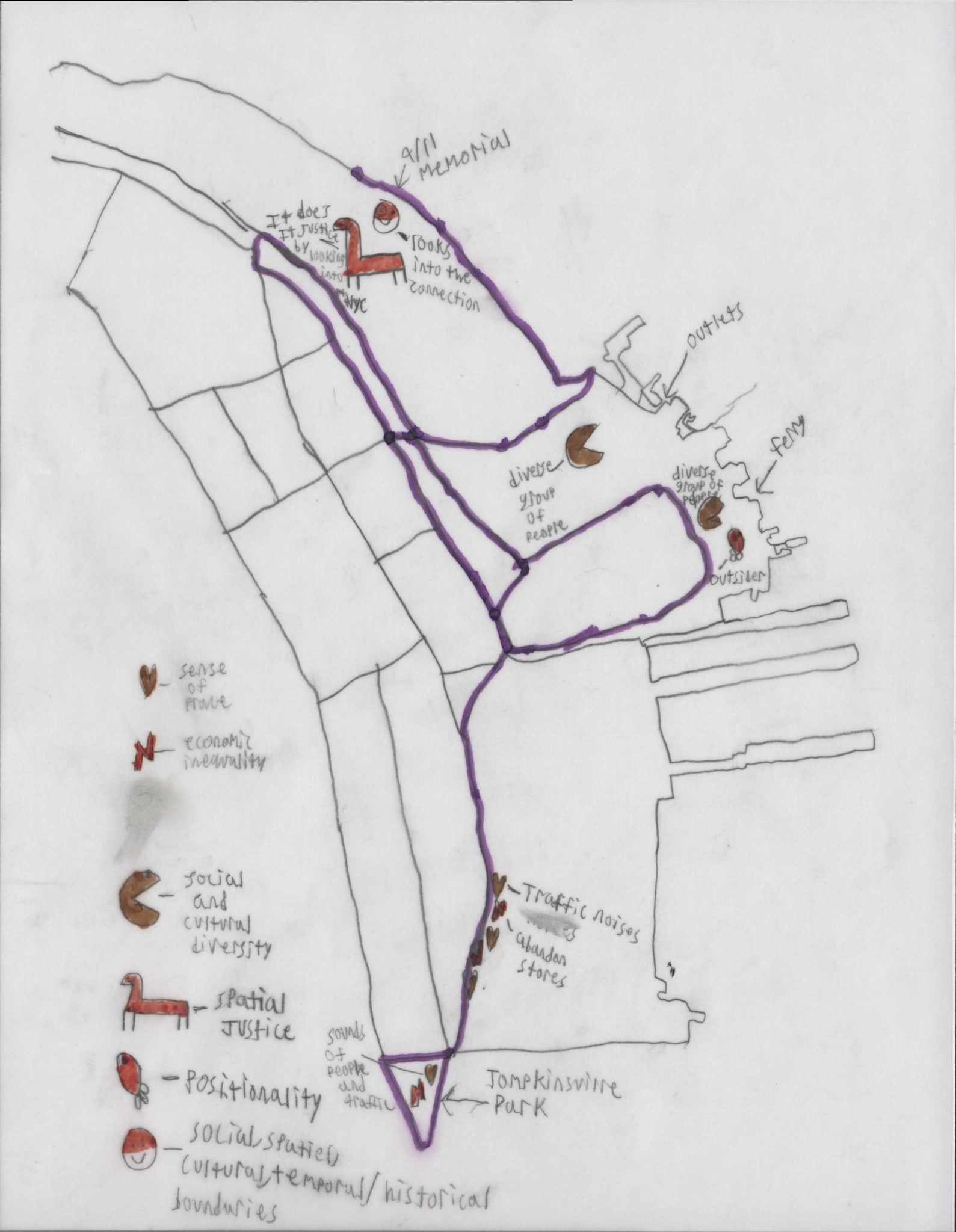
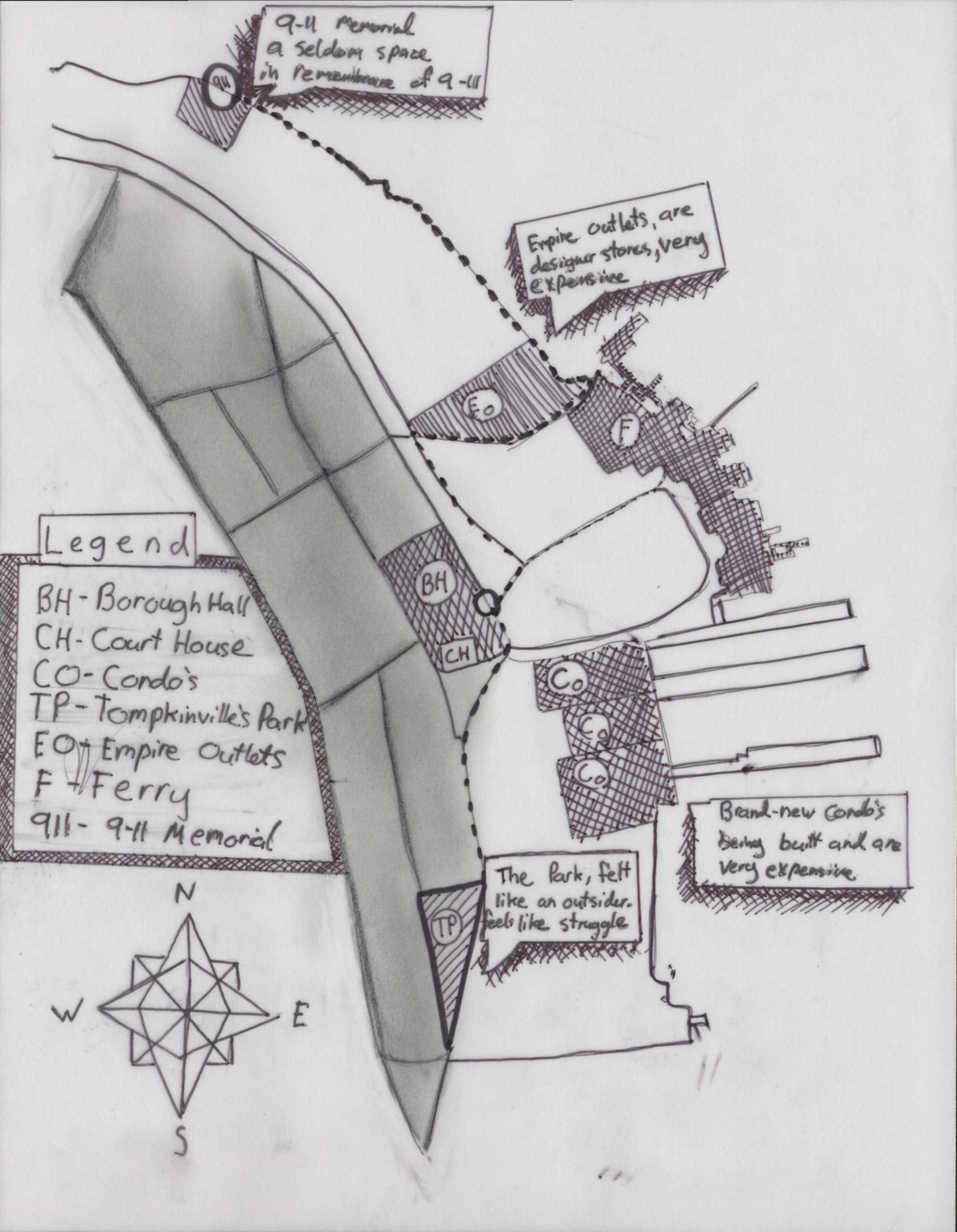
Through “thick mapping” (Presner, Shepard, Kawano 2014), students created their unique mental maps of Bay St. in Staten Island. Focusing on Tompkinsville Park, passing through the Staten Island Ferry Terminal and all the way to the waterfront area, the maps presented here give us a multilayered, multidimensional, multimodal, nuanced and intimate understanding of Staten Island’s North Shore.
Each of these maps tells a story and makes an argument about the past, the present, and the future of Staten Island. This collection of maps of Staten Island hand-drawn by over 30 students is a first of its kind.
Follow us @GeospatialCSI on instagram, facebook & twitter.